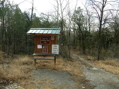
 TO TRAILHEAD: I-40 E to exit 226A to TN 171 S/S. Mount Juliet Rd. In 4.2 miles, bear left on S. Mount Juliet Rd./TN-171. In 1.1 miles, left onto Couchville Pike. In 2 miles, right onto Barnett Rd. Continue 0.5 mile to trailhead parking lot. A popular local mountain bike destination, the Jones Mill Trail in Long Hunter State Park is an oft-overlooked option for Nashville-area dayhikers and trail runners. Winding through a sparse cedar forest, this 3.5-mile figure-eight loop samples limestone glades (home to the endangered Tennessee coneflower), interesting varieties of trailside moss, and birdwatching spots atop reservoir bluffs. Start from the Jones Mill Trailhead on Barnett Road and begin hiking clockwise on the Main Moop—keep an eye out for patches of reindeer moss on the side of trail. One mile in, you'll start the counter-clockwise loop to Bald Knob (an overlook of Percy Price Lake where you may hear or see common loons—and where bald eagles have been spotted in the past). Descend from Baldy Knob and head west through the cedars, making an optional shoreline detour on the return loop before the trailhead. 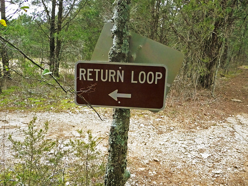 The cache is about one mile into the 4 mile hike. Here are the cache coordinates: N 36° 04.591 W 086° 30.448 Dont forget to sign the logbook and take something but leave something also. View Larger Map |
Sunday, January 30, 2011
Jones Mill Hiking Trail
Base of a young cedar
This geocache is on a small trail off South Mount Juliet road. If you are coming from I-40, the geocache is on the only trail that is on the right. There is a small parking area is on the right when you turn off South Mount Juliet road right before it becomes Hobson Pike.
Enter the memorial trail and turn on your GPS.
Here are the coordinates: N 36° 06.162 W 086° 31.921
View Larger Map
Enter the memorial trail and turn on your GPS.
Here are the coordinates: N 36° 06.162 W 086° 31.921
View Larger Map
End of the fence, begining of an adventure
This geocache is at a finger along the shore of the percy priest lake. The hike is rated a 2.5 from 1 to 5 and the cache location is rated a 2 out of 5. Just plug in the coordinates and you will be able to find the cache.
This cache can be found by starting at the intersection of Weakley Lane and Rockdale Fellowship Drive. At the 3 way intersection is the old rockdale fellowship road that enters the woods, grown over now, but still a trail exists. Follow the trail and turn on your gps once you reach the water's edge.
Here are the coordinates: N 36° 03.020 W 086° 28.956
View Larger Map
Subscribe to:
Posts (Atom)